Tuesday, November 18, 2014

In the Arctic Circle most people think of a lot of snow all the time.  Over much of the Arctic, precipitation amounts are low. Some areas are called polar deserts and receive as little precipitation as the Sahara desert. However, the Atlantic part of the Arctic, between Greenland and Scandinavia is an exception.


The chart shows how little precipitation the Arctic Circle gets. In comparison Denver gets about .65 Inch to 2.5 inch's a mouth.  


 In resent years "global worming" has been a very hot topic. People are getting nervous that in the Arctic Circle a lot of the glaciers will start melting. the real reason that the snow is melting is the ice-albedo feedback, whereby an initial warming causes snow and ice to melt, exposing darker surfaces that absorb more sunlight, leading to more warming. Its not just "Global Worming" that is going to melt all of the frozen water we have. 


This chart shows how the temperature has changed from 1951 to 1980 


 The Coriolis force explains why winds circulate around high and low pressure systems as opposed to blowing in the direction of the pressure gradient. The following picture shows how wind is deflected in each  different part of the world. 


The winds from the Coriolis effect can change the pattern of an object moving through the air.


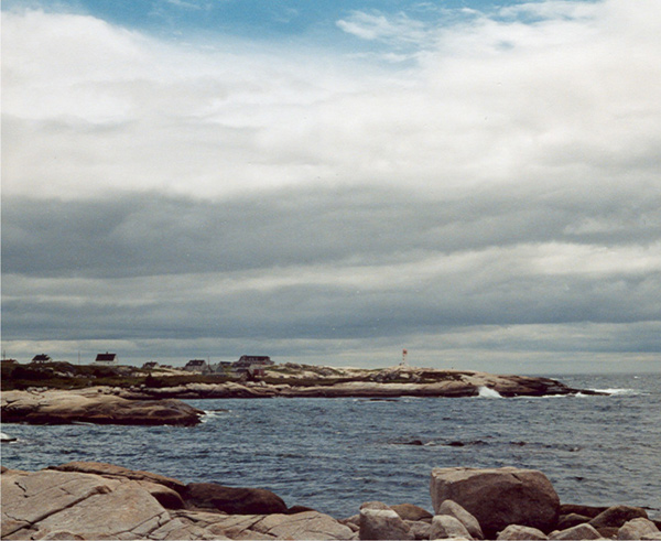
All air contains at least some water vapor, but the amount of water vapor changes a lot from place to place and from time to time. The amount of water vapor in the air can change because water evaporates up from the ground, water, or even plants at different times and different amounts. If you are in the Arctic Circle you might see a Stratocumulus cloud like the picture below. 

Stratocumulus clouds over a rocky shoreline


Stratocumulus clouds appear larger because the clouds are not that high up in the sky (about to Km high up). Sometimes the clouds look like one big cloud but other times you can see the blue sky peaking through the clouds. 


Thursday, November 6, 2014

The Arctic Circle

My name is Frank Muehlfelt I am a freshman this year and I just moved here from Chicago. I will be doing my blog on The Arctic Circle because it has always been fascinating to me and I would like to learn more about this area. One thing that I will do before I die is go up into the Arctic Circle to see the Northern Lights in person.

Nearly one-third of Alaska lies above the Arctic Circle. The region exhibits a wide range of coastal landforms and reliefs fashioned by the processes of volcanism, glaciation, faulting and folding. Right around the 66th latitude their are tundra's a very popular landscape type in most of the Arctic Circle.
Tundra-"a vast, flat, treeless Arctic region of Europe, Asia, and North America in which the subsoil is permanently frozen 10 inches to 3 feet down so that trees can't grow there." frommerriam-webster.com  I think that Tundra's were created by extremely long periods of cold weather, and other places in the world do not experience this type of weather. Along with the cold weather because the ground is frozen a lot of plants cant grow in this reign of the world and because of this there is nothing to stop wind from gusting so it is even colder.  


This picture illustrates the "might night sun"
Tundra's are extremely cold most of the year because it is very far away from the equator. Because of the earths tilt many places in the Arctic Circle experience cold weather along with longer nights in the winter because the sun dosnt directly hit them.While the sun doesn't shine much during the winter, it shines on the entire region for part of the day from March to September.
As you can see it can get very cold in the Arctic Circle.
Because of the cold weather in the Arctic Circle it makes it very hard for people to live in this region of the world. Also many people like to see the sun and when it hides for some of the year people d not like this. Tundra's have stayed about the same for the last couple of generations. They have stayed the same because of how little people inhabit these kinds of areas. Because this reign of the world is not very livable many brave scientist make the journey up their to research.  
Most of the water within the Arctic circle is frozen because of how cold the weather is in that regain of the world. The regain does have some non-frozen water like the Mackenzie river. 
The Mackenzie River is one of the largest rivers in Candida. 

The Mackenzie River (great river) is the largest and longest river system in Canada and the second largest on North America second just to the Mississippi River  in North America. It flows through a long isolated region of forest and tundra entirely in the country's Northwest Territories although its many tributaries reach into four other Canadian provinces and territories. The river's mainstream runs 1,738 kilometers (1,080 mi) in a northerly direction to the Arctic Ocean, Draining a vast amount of water. It is the largest river flowing into the Arctic from North America,
Rivers normally begin in mountains or large hills where they form from streams called gullies from a lot of collected rain water and or melted snow. These gullies will either grow larger after collecting more water or they will meet with streams and add on to that water. When streams converge (meet) the smaller of the streams is known as a tributary. The point at which the two streams meet is called a confluence. In order to form a river it takes many tributary streams.The Mackenzie River has many tributaries to name a few Great Bear River,Great Slave Lake and the  Keele River.

The Delta of the Mackenzie River is a large amount of water. Not all rivers flow north to south like many people believe. 

The delta is a maze of channels, cutoff lakes and circular ponds  bordered by the Richardson Mountains in the west and the Caribou Hills in the east.


.
The Mackenzie River has many small tributaries, this picture shows some of them

I think that the Mackenzie River started because of melting show or ice that started to flow downhill. Then the river has small tributaries that made the river flow stronger and stronger until it reaches its delta in Candida.  "Significant evidence exists that roughly 13,000 years ago, the channel of the Mackenzie was scoured by one or more massive glacial lake outburst floods unleashed from Lake Agassiz, formed by melting ice west of the present-day Great Lakes. At its peak, Agassiz had a greater volume than all present-day freshwater lakes combined. This is believed to have disrupted currents in the Arctic Ocean"
  1. Natural Resources Canada. 2007-12-20. Retrieved 2008-06-16.